Snappers using selected Sony digital stills cameras and camcorders can pinpoint the exact location of their shots using a small Global Positioning System (GPS) device that the company is adding to its range at the end of the month.
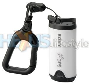
The GPS-CS1 is a 12-channel unit that weighs 55g (2oz) and measures 87mm (3.5in) in length and 36mm (1.4in) wide. It's said to run continuously for 10 hours using a single alkaline battery or for 14 hours with a Ni-MH battery. Price in the USA is slated at $150, so we'd hope it will sell in the UK for under £120.
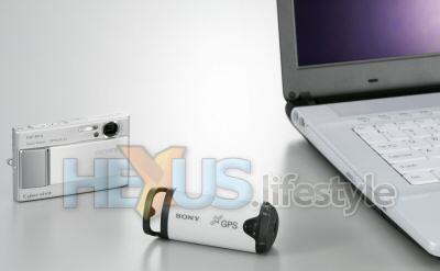
Camera and GPS device work independently of one another - the picture and positioning information are brought together in a Windows PC to which the GPS device attaches by USB. Sony's GPS Image Tracker software synchronizes the images with the latitude, longitude and time readings from the GPS device and is supplied with the GPS-CS1 and certain cameras from August.
There's also an option to see on a map where you've been shooting, thanks to a tie-up between Sony and Google Maps. The map scale is adjustable and can be switched between various formats - outline, satellite, global or local.
Sony says that the GPS-CS1 can be used with all Cyber-shot still cameras launched from August 2006 onwards, and with certain new camcorders (for stills only) and the company's Alpha 100 digital SLR - though shots must be in JPEG or JPEG+RAW mode.
A number of older Cyber-shot models are also said to be compatible - the DSC-W100/70/50/40/30, H5/2, T30 and S600/500/45. However, their supplied Cyber-shot Viewer software needs to be updated to add Map View functionality from the CD that comes with the GPS unit.
Set-up of the GPS-CS1 is claimed to be simple and the device is said to work automatically. It captures fresh location data every 15 seconds and is reckoned to need no control adjustments during tracking and recording. The GPS-CS1 can hold 31MB of data, said to be equivalent to one month of tracking and recording for 12 hours a day.
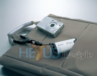
The device attaches to a belt-loop or backpack with a supplied carabineer, use of which helps ensure that the internal antenna remains in a near-vertical position for good reception. Positional accuracy will vary according to the status of satellites but is said to be as high as 2m in optimal conditions.
When a photo is taken between two log points, the GPS Image Tracker software makes an estimate of the location based on those two points. Estimation is also used when a photo is taken where no satellite signal available, such as when briefly underground or indoors.
Thoughts? Share them with us in this thread in the HEXUS.lifestyle.news forum.
HEXUS.links
HEXUS.community : : Discussion thread about this deviceHEXUS.headline - Sony details its July-arriving first digital SLR camera
Sony Europe - home page


